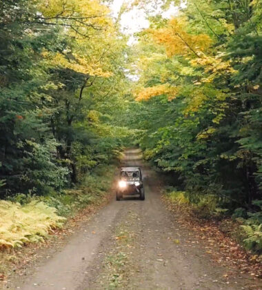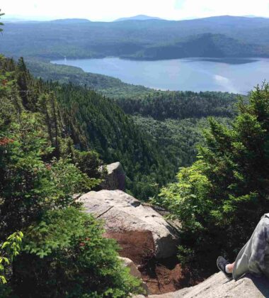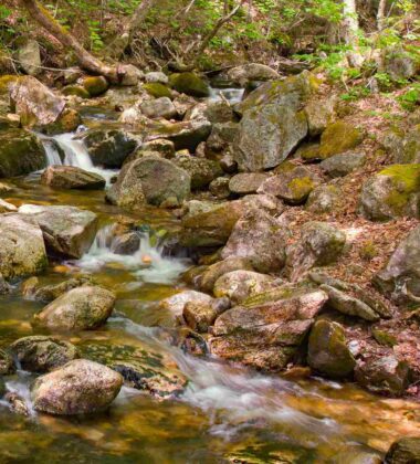
For most hikers, a sense of solitude is just as important as scenery and climbing mountains. Our miles of trails offer a rewarding hiking experience without the crowds of the White Mountains. Explore the Great North Woods by Hiking in New Hampshire!
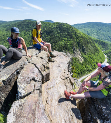
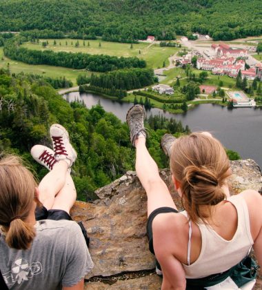
Dixville Notch is home to several fun hikes with beautiful scenery. They include Sanguinary Ridge and Table Rock, one of the most iconic and rewarding hikes in all of New Hampshire. The views from Table Rock – a narrow ledge rising several hundred feet over a cliff face – are purely breathtaking, and for hiking in New Hampshire’s Great North Woods, it’s hard to beat.
The North Country’s mountain peaks might not be quite as tall as some others in the state, but they offer challenges and views that are every bit as rewarding. Mountains like Magalloway, Percy Peaks, Monadnock, Brousseau, Sugarloaf and others provide challenging climbs, sweeping summit views and no crowds.
For hikers looking for a long-distance challenge, the North Country is home to the Cohos Trail, a roughly 170-mile trail connecting the northern and southern ends of Coos County. Those looking for a fun short hike will enjoy the hike to Fourth Connecticut Lake. The scenic trail is a little more than a half-mile long and runs along the Canadian border to the source of the Connecticut River. Hiking isn’t just for adults, for a full list of kid-friendly hikes click here.
There’s an adventurous spirit in all of us. In the Great North Woods, you can answer that call by becoming a Go North 9er. Rise to the challenge and become an official “Go North 9er” by climbing all nine peaks.
Whether you’re looking for a hike that is long and challenging or short and fun, the North Country’s hiking trails offer you a chance to escape the crowds, view breathtaking scenery and reconnect with nature.
AVERILL MOUNTAIN (Norton, VT): Take Route 3 north to West Stewartstown and take a left onto VT Route 114S. Proceed to the Averill Lake View Store, 0.5 miles from the store is a small white sign for Averill Mountain. The mountain has a gradual ascent with a vertical rise of 550 feet from the trails starting point. The trail is very well marked and upon reaching the summit, the hiker can see Table Rock in Dixville, N.H., Mt. Washington, and Jay Peak.
BLACK CAT TRAIL (Pittsburg, NH): Drive North on Route 3 until you reach Deer Mountain Campground. The Mile Marker is 237.4 and park. Walk South West on Sophies Lane. Turn left at the kiosk onto the snowmobile corridor 5 heading towards Route 3 Watching for The Upper Black Cat trailhead on the right. This trail is easy to moderate.
BLACK TURN BROOK HIKING TRAIL (Norton, VT): Take Route 3 north and take a left onto VT Route 114S in West Stewartstown and continue through Norton Village. Drive 5.7 miles from Norton and take a right turn from 114S onto Black Turn Brook Road. Park in the lot as the trail is gated. This Black Turn Brook hiking trail is well worth the hike as rare fauna can be found here. The Lobster Mushroom and the Yellow Lady Slipper are just two of the unusual plants found in this area. At present, the trail is in need of some clearing, but there is still plenty to explore.
BOG BRIDGE TRAIL (Pittsburg, NH): Drive North on Route 3 to Magalloway Road mile marker 231.3. Travel 1 mile on Magalloway Road to the state parking area at the bridge crossing the river. You enter the woods to the right. A little over a mile of hiking and the trail crosses a snowmobile bridge spanning Coon Brook. This trail is moderate.
BROUSSEAU MOUNTAIN (Norton, VT): Go west on Route 114 in Averill, Vt., 1.5 miles from Lake View Store. Take a left onto Mountain Road. 1.3 miles down Mountain Road there is a dead end gate. Turn your car around so you don’t block anything. About 35 minutes to the top on a well-marked trail At this point there is no view. Take another trail to the right, this leads to a lookout point, about two minutes away. This provides a wide panorama view of the White and Green Mountain ranges. Wildlife is also part of the view.
CAMP OTTER TRAIL (Pittsburg, NH): Drive North on Route 3 4.7 miles past the First Connecticut Lake Dam to Magalloway Road on your right. Take Magalloway Mountain Road and travel 1.1 miles to the NH State Kiosk/parking area after the bridge crossing the Connecticut River. The Camp Otter Trail enters the woods to the west and follows a narrow path for roughly .2 miles before turning left on a woods road. A little over a mile the trail crosses a snowmobile bridge spanning Coon Brook then steps onto one of the longest bog bridges in the state of New Hampshire, covering over 800 feet. Bear left and run parallel to the open grassy way for a few hundred feet then follow the yellow blazes up to the abandoned roadbed heading south. The roadbed gives way to a pleasant trail that runs alongside new-growth clearcuts with a abundant wildlife. This trail takes you 2.9 miles to Camp Otter Road with no parking available at the southern terminus. This trail is part of the Cohos Trail.
CLARKSVILLE FREEDOM TRAIL (Clarksville, NH): The Freedom Trail is the only trail in the North Country that will accommodate people in wheelchairs. It’s a limited mobility access trail. This mile-long nature trail traverses wooded land and has several loops including difficulties of grades ranging from easy to intermediate. Hikers are advised to stay on the trails. Let someone know where you plan to go. You can take a nice walk with a baby stroller, or enjoy lunch. Please take out what you bring in. Located off from Route 145 in Clarksville, on the Bressette Road, near Ben Young Hill.
COHOS TRAIL: Is a long distance hiking trail that starts at Crawford Notch in the ‘Whites’, traverses through the Kilkenny region, Nash Stream Forest, Gadwah Notch, Dixville Notch and into the Clarksville-Pittsburg lakes and streams area. It’s approximately 170 miles in length and goes through some of the most remote territory the North Country has to offer. For more details, visit The Cohos Trail’s website.
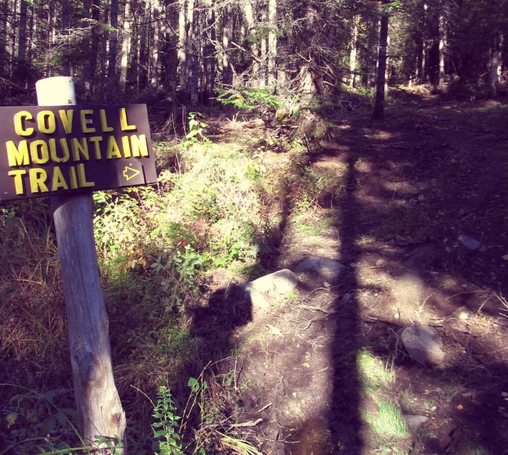
COVELL MOUNTAIN TRAIL (Pittsburg, NH): Travel North on Route and turn left onto Golden Eagle Drive. Mile marker 227.5. This dirt road ends at Ramblewood. This hike is moderate.
DEER MOUNTAIN FIRETOWER TRAIL (Pittsburg, NH): The Cohos Trail Association has restored a number of trails in Coos County, NH, and this is one. It begins on a spur road off Sophie’s Lane west of Deer Mountain Campground about four miles from the Canadian border. Walk Sophie’s Lane half a mile until a spur lane rises on the left. Walk up it until it ends. The trailhead is on the left (west) in a small turnaround lot. The hike is an easy to moderate climb in quiet woods, crossing three streams as you climb higher. In less than an hour reach a high elevation drained bog. Now begin to climb more steeply and reach a narrow waterfall. Crest the summit ridgeline and walk north on the ridge until the steel superstructure of an abandoned fire tower comes into view. This is the summit of Deer Mountain, a spot that seems far removed from anywhere.
FALLS IN THE RIVER TRAIL (Pittsburg, NH): One of the most popular trails on the Cohos Trail. Begin at Second Connecticut Lake Dam and walk south into the woods. This is an easy woods walk along the wild Connecticut River. It reaches quiet backwaters and chattering streams, but the real prize is a big granite shelf that juts out into the roaring falls in the river above a narrow gorge and turbulent flume of foaming water.
FOURTH CONNECTICUT LAKE TRAIL (Pittsburg, NH): Tucked into a mountain valley just below the Canadian International Border lies Fourth Connecticut Lake (elevation 2,670′). Here in the headwaters region of the Connecticut River, water gathers in a small, quiet, pristine 1.8 acre pond rimmed with abundant plants and wildlife. The gentle, gurgling brook flowing from this pond is the beginning of the Connecticut River, New England’s greatest and longest river. The trailhead is located in back of the US Customs building and parking is located across Route 3 from the customs building. The Fourth Connecticut Lake is also the beginning of the mighty Connecticut River that flows down through 4 states (400+ miles) and empties into the ocean at Long Island Sound, N.Y.
GARFIELD FALLS (Pittsburg, NH): Take Route 3 North to mile marker 231.3 on the right side of Route 3. Drive 13 miles out as it turns the corner stay to the left where you pass through an orange gate. Stay straight at the critical junction for a few more miles. Look for the kiosk on the left across from an outhouse. The falls are about a ten-minute walk down. This is a moderate and steep hike.
GORE MOUNTAIN (Norton, VT): Take Route 3 north to West Stewartstown and take a left onto VT Rt. 114S. Continue through the village of Norton for another 9.9 miles. Look for Lake Station Road at the north end of Norton Pond and pull off between that and Devost Road. The trail enters through a small opening on the east side of the road. The hike includes a series of beaver meadows, crossing several brooks and hiking through the edge of an expansive logged-off area. From the summit there are limited views of the Nulhegan Basin. Length of the trail to the summit is 3.8 miles.
HEREFORD MOUNTAIN (East Hereford, QC): Take Route 3 north to VT 253 (7.0 miles). Turn left to Beecher Falls. Proceed through Canadian Customs. Continue to sign Rue Principale (11.8 miles). Turn left onto Rue Principale and go 3.1 miles to the Mount Hereford trail entrance on the left. Look for a large entrance sign that says Sentiers Pedestres and Neil Tillotson in smaller print underneath. The trail is well marked by orange paint or ribbons. The first half of the walk has beautiful flora such a purple fringed orchid. It is 3.5 miles (5.5km) to the summit. From there it is a nice 360-degree view! Alternative route: If you’d prefer to drive to the top, From Colebrook, take Rt. 3 to West Stewartstown – turn left after The Spa and stay on this road through town then take a right onto Rt. 141 and proceed through the Canadian Customs. Stay on this road until you see the second sign for St. Hermenegilde, turn right here, stay on the paved road through the village and keep going until you reach a “T”. Take a right and stay on this for about 2 miles or less, the sign will be on your right.
INDIAN STREAM CANYON (Pittsburg, NH): Located at the headwaters of the Indian Stream, the Canyon is a half mile gorge that holds a variety of geological rock formations, such as zebra striped rocks, created when white quartz forced its way into gray slate. There are beds of boulders, some of them pink granite, that were deposited when glaciers moved through thousands of years ago. To get to the Canyon, take Indian Stream Road, off of Route 3 in Pittsburg, to mile marker 16. There you will find signage for the trail.
LAKE FRANCIS TRAIL (Pittsburg, NH): Take Route 3 to Pittsburg and look for River Road (second right past Young’s General Store). Drive .7 miles down River Road to Carr’s Ridge Road on the left and park before the bridge of the Connecticut River. The trailhead is located by crossing the bridge and taking an immediate right. Bear right at any questionable junction. This trail is approximately 4.1 miles in length and brings you out to Cedar Stream Road in Clarksville after passing the 6-mile view from the shore of Lake Francis. This trail is part of the Cohos Trail.
LITTLE HELLGATE (Pittsburg, NH): Named “Hellgate” because many a logger lost his life here breaking up log jams. To get there, drive north on Rte 3 to Pittsburg to Magalloway Road (about 11 miles north of the village). Turn right onto Magalloway Road. Take Buckhorn Road which is the second right off of Magalloway Road (about 3 miles). You will pass through a gate after 3-4 miles and the road becomes the Cedar Stream Road. Look for snowmobile trail #137 on the left. Park on the side and start down the the snowmobile trail. You will cross 2 snowmobile bridges. The trail head is located on the left, immediately after crossing the second bridge. The trail is beautifully done with log stairs and log benches. The trail into the falls is very steep so use caution in this section.
MAGALLOWAY MOUNTAIN (Pittsburg, NH): The trailhead is located in Pittsburg. Take Route 3 past 1st Connecticut Lake about 3 miles north. Take a right onto the Magalloway Road. Stay straight on this dirt road until you see the ‘fire tower’ signs ~take a hard right. Follow this road to the end to a grassy parking area. Caution: This is a main logging road and logging trucks have the right of way. It’s just a 40 minute hike before you can climb the fire tower and are able to take in four counties and breathtaking views.
MIDDLE MOUNTAIN (Avery’s & Warren’s Gore, VT): This trail combines numerous logging trails, game paths, and new segments to explore the deeper forests of the Northeast Kingdom. This trail passes through private property, so please respect the landowner and protect future access by staying on the marked trail and following all rules. This trail starts at VT-114 using portions of the historic Unknown Pond Trail and climbing out of the valley along the ‘south arm’ of Middle Mountain. The trail starts on Unknown Pond Trail, then in 1.3 miles becomes Middle Mountain Trail. It continues to climb to the summit of Middle Mountain (2,949 ft), from which hikers can continue on the trail to descend the north side of the mountain and join with the Gore Mountain Trail. Take Route 3 north to West Stewartstown and take a left onto VT Rt. 114S. Continue on VT 114S for 22.1 miles. You will pass Norton Pond on your right. The parking and trailhead will be on your left. If you pass Hurricane Brook Road you’ve just passed it.
MONADNOCK MOUNTAIN (Lemington, VT): The trailhead and parking can be found on Route 102 (Vt.) Take Bridge Street in Colebrook, follow to the end – take left at stop sign – park on the left. The trail is just north of the parking on the left side of the road. About a two-hour hike, an old fire tower is situated atop the mountain allowing one to view two states.
MOOSE ALLEY TRAIL (Pittsburg, NH): Take Route 3 north 4.7 miles past First Connecticut Lake Dam and watch for Magalloway Road on your right. Take Magalloway Mountain Road and travel 1.1 miles to the NH State Kiosk/parking area after the bridge crossing the Connecticut River. The trail enters the woods to northeast across from the Camp Otter Trail and travels 1.7 miles to mile marker 232 on US Route 3 by Big Brook Bog Road. At 1.6 miles there is a trail junction with the Falls in the River Trail. Parking at the northern terminus is located at the pull-out just north of mile marker 232 and Big Brook Bog Road on US Route 3. If snowshoeing, start at this point. This trail is part of the Cohos Trail.
MOUNT SANGUINARY (Dixville, NH): Take Route 26 east from Colebrook to the Flume Brook Picnic Area in Dixville Notch State Wayside (on the left, east of the height of land about 0.9 miles). Park here and take a scenic trail through balsam and spruce forest to a spectacular view from a rocky pinnacle overlooking Lake Gloriette and The Balsams Grand Resort Hotel. It is one mile from the picnic area to the overlook and 1.5 miles from the picnic area to The Balsams Hotel road entrance. Some of this is part of the Cohos Trail.
NORTH & SOUTH PERCY (North Stratford, NH): North Percy Trail is a 3.8 mile lightly trafficked out-and-back trail located near North Stratford, New Hampshire that features a great forest setting and is rated as difficult. The trail is primarily used for hiking and is best used from May until October. The Cohos Trail Association built or restored a number of trails on the conspicuous and steep Percy Peaks in the Nash Stream Forest north of the White Mountains. You can make a half-day loop hike to both North and South Percy Peak summits by following the Percy Loop Trail to the upper end of the Percy Peaks Trail. The Percy Loop Trailhead is 1.2 miles beyond the Percy Peaks Trailhead, on the right, and is signed. Parking is on the left next to a driveway to a camp. Be sure not to block the driveway.
PINNACLE MOUNTAIN (Baldwin Mills, QC): Go west on Route 114 to Norton. Go through the customs into Canada. After 0.6 miles turn left towards Stanhope. The road becomes dirt in 1.7 miles, continue. After 3.4 miles on the dirt road, bear left onto May Road. Go 1.9 miles into Baldwin Mills. Park your car in public parking near the store on the right. There are three trail options. Climb the BLUE TRAIL (less grade) at entrance on “L” just before the Stop sign on Allard Street. Or walk along Allard Street to the RED TRAIL on the left at the sign saying “Cul-de-Sac” (steeper). Also try one just off the parking lot at the fishery in Baldwin Mills. This is well marked and follows a creek up to Baldwin Village where you can connect to the Mt. Pinnacle Trail.
RIVER WALK (Colebrook, NH): The Riverwalk is a beautiful easy hiking loop along the Mohawk and Connecticut Rivers. It travels through the forest and accesses the North Country Community Recreation Center and the Upper Coos Recreational Rail Trail. It is marked with brown and white signs. From the municipal lot, the trails heads east along the south bank of the Mohawk River. At the Upper Coos Recreational Rail Trail, the River Walk turns right and crosses the old railroad bridge. Immediately after the bridge, the River Walk heads left into the woods again and follows the north bank of the Mohawk River to its confluence with the Connecticut River. This section includes three benches for rest and interpretive signs labeling the vegetation along the trail. There is also an alternative route signed as the Long Loop. At the Connecticut River, the trail heads north along the river’s edge. It then heads back to the Upper Coos Recreational Rail Trail along the edge of a field. The River Walk turns left at the rail trail then right at an ATV and snowmobile access trail and goes uphill to the North Country Community Recreation Center. At the Recreation Center, the trail skirts the edge of the lawn and enters the woods again parallel to the Recreation Center’s access road. At Lynch road, the trails turns right, then enters the forest again on the left. It crosses a bridge then follows the north bank of the Mohawk River. It crosses a snowmobile bridge back to the municipal lot.
SUGARLOAF MOUNTAIN (North Stratford, NH): This trail is a 4.4 mile lightly trafficked out-and-back trail located near North Stratford, New Hampshire that features a great forest setting and is rated as difficult. The trail is primarily used for hiking and nature trips and is best used from May until October. From Colebrook take Route 3 South to Groveton, N.H., take a left off of Route 3 to get onto Route 110 East. After 2.6 miles on Route 110, take a left onto Emerson Road. Follow this road for 2.2 miles until the road makes a sharp right-hand turn. At this point, turn left onto Nash Stream Road and follow it for 10.4 miles to a small, signed parking area on the right.
TABLE ROCK (Dixville, NH): This stark protruding cliff is formed of vertical slabs. It is less than 10 feet wide at its narrowest point. The vertical drop from table rock is 700 feet. Use Caution! The view is spectacular! Directions to Table Rock are: Take Route 26 east from Colebrook about 10 miles. Park in the gravel area on the right, about 150 feet prior to reaching the top of Dixville Notch, the trail ascends almost vertically from the parking area. The trail starts almost directly behind the big sign “Entering Dixville Notch State Park.” This trail is steep and rocky and should NOT be attempted when wet. The trail is 0.3 miles from the parking area to Table Rock. There is an alternate route that is accessible from a trail originating on Route 26, 0.2 miles east of the junction of the access road to The Balsams/Wilderness Ski Area and Route 26. Park off the road shoulder in the grassy clearing on the right. The trail starts 70 feet before the yellow caution diamond road sign. This trail is well marked, with many small signs. The alternate route is the safest way to climb up!
THREE BROTHERS TRAIL AND HUNTINGTON CASCADE FALLS TRAIL (Dixville, NH): Take Route 26 east from Colebrook to Dixville Notch State Wayside (on the left, east of the height of land about 0.9 miles). Starts out on the Huntington Falls Trail to the Three Brothers Trail then 3 miles to Table Rock. This trail makes a loop back down to a parking lot across from Lake Gloriette and the Balsams. This is part of the Cohos Trail.
WASHBURN FAMILY FOREST (Pittsburg & Clarksville, NH): The Washburn Family Forest and its 2,100 acres are open to hiking, mountain biking (on the gravel roads only), fishing, hunting, bird watching, cross-country skiing, dog walking, snowmobiling, and snowshoeing. The gravel road system of more than 9 miles allows access throughout the entire property. Parking is available off Route 3 just south of the Pittsburg/Clarksville town line. There you will find an informational kiosk with a property map. A hiking trail leads from the kiosk on Route 3 along the river and up into the property and the internal gravel road system. Please do not access the property from the abutting private land as indicated on the map. There are outstanding views of the Connecticut River valley and Indian Stream from the eastern portion of the interior road system.


