The North Country has been a beloved destination for visitors since the late 1800s. Our History means that today, we continue to be that tradition of being a favorite escape for people looking to experience natural beauty, thrilling outdoor adventures and the culture and history of this fascinating region.
For centuries, logging and farming have been the foundation of the North Country, and the people of this region are known for their colorful, independent spirit. In fact, that independent spirit even led to part of the North Country being its own nation for a short time. Due to a border dispute between the United States and British-controlled Canada during the early 1800s, some North Country residents declared their independence in 1832 and founded the Indian Stream Republic. The republic remained independent until the border dispute was resolved in 1840.
Visitors began flocking to the North Country in the late 1800s, taking the train from cities like Boston and New York City. In the North Country, the fresh mountain air and beautiful wilderness landscape provided visitors welcome relief from city life. Hunting lodges began to spring up in the region as the North Country gained a reputation for being a wonderful place for fishing and hunting.
Today, the North Country is experiencing a renaissance. Still popular among hunters and fishermen, the region is also attracting people who enjoy hiking, paddling, biking, ATVing and snowmobiling. New businesses are injecting new life into the region, and interesting craft stores, wonderful bakeries and high-quality restaurants are helping to make the North Country one of the most fun and interesting destinations in New England.
Explore the North Country and you’ll discover a fascinating history behind this exciting destination. For information on local historical societies and resources, please give us a call at 603-237-8939 or email info@chamberofthenorthcountry.com.
Please note: if you have historical information that you would suggest we add to this page for the communities the North Country Chamber of Commerce covers, please let us know! We are grateful for contributions or further resources to link to. We cover the New Hampshire towns of Clarksville, Colebrook, Columbia, Dixville Notch, Errol, Millsfield, North Stratford, Pittsburg, and West Stewartstown and Vermont communities of Averill, Beecher Falls, Bloomfield, Canaan, Lemington, and Norton.
-
Courtesy of Lopstick -

Courtesy of Lopstick -

Courtesy of Lopstick -

Courtesy of Lopstick -
Courtesy of Lopstick -

Courtesy of Lopstick -
Courtesy of Lopstick -
Courtesy of Lopstick
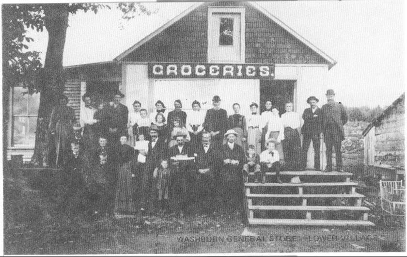
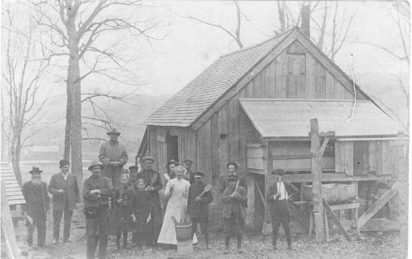
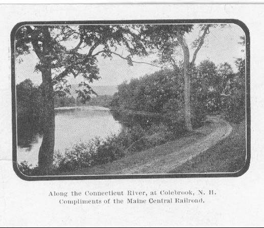
Town of Colebrook History
Visitors in the late 1800s came in droves to New Hampshire’s Grand North to experience a completely different way of life within a short train ride of Boston or New York. Peppered across the mountainous and forested northern landscape were over 200 hotels, inns and boarding houses ready to welcome visitors and offer them fresh mountain air and a change of pace during the summer months.
Women and children typically played croquet, rode horses and swam while the men took part in polo, golf, and an occasional hunting expedition. Northern New Hampshire offered a perfect social and sophisticated get-a-way from the hustle and bustle of the cities.
The invention of the automobile in the early 1900s opened up the country to another type of travel. Instead of going on a train to specified destinations, an automobile allowed a family to go wherever the roads would take them. City visitors started taking vacations in places other than northern New Hampshire.
A series of fires destroyed a majority of the Grand Hotels, while others were abandoned because of the lack of visitors and left to be taken down several years later. The paper industry was in full swing, and locals focused on farming the forest. At one point, Berlin, with its premier location on the Androscoggin River, was home to the largest paper mill complex in the world. Boom piers, man-made islands, were used to secure chains of logs, which divided the river between the two logging companies, so logs could be channeled to the proper mill during the spring log drives. The piers still stand in the river today and are ceremoniously set ablaze for the spectacular “River Fire” event in October.
Twenty-first-century visitors fond of the rustic and majestic feel of the area travel to the region to experience another way of life. The majority of the vintage hunting lodges that once occupied the shores of the Connecticut Lakes have since disappeared, though anglers and hunters still journey to those remaining for the experience of catching an enormous land-locked salmon on the “Trophy Stretch” or finding the perfect eight-point buck. The Northern Forest Heritage Park interpretive center in Berlin gives visitors a glimpse of life in the logging camps. Hikers ascend into another world altogether as they travel across the Presidential Mountain Range of the White Mountains, catching the first view of sunrise every morning.
From the Town of Colebrook’s Master Plan, Oct. 2013: Historical Perspective
The area that is now Colebrook was originally sold twice. In 1762, Governor Benning Wentworth sold it to 64 individuals as “Dryden”. The requirements of the deed were not honored, so in 1770, Governor John Wentworth sold it to Sir George Colebrooke as Colebrook Town. Again, this time because of the Revolutionary War, the land was not occupied. Thus, when the first settlers came into this area around 1780, no one owned the land. They settled wherever they wanted to and took as much land as they needed for their own purposes.
The census of 1790 completely ignored the town’s physical being, although several settlers had already established themselves here. In 1795, with thirty families in the town, the need for recognition and incorporation was felt, and a petition bearing their names was presented. On June 11, 1796, the town became incorporated. From this time on, the town grew rapidly, and by 1800, it had 160 inhabitants.
The first school was erected in 1795 and the first church, the Congregational, was founded in 1802.
Agriculture and lumbering were the important industries at the time. Lumbering and its products created several fortunes and provided cash incomes for generations of our citizens.
The first sawmill in the Colebrook area was built and run by the MacAllaster brothers about 1800. In the course of a hundred years, about 16 sawmills were known to exist. Brick kilns were also one of the first industries in town. The first one known to exist was behind the present Colebrook House. The Walker House, which still stands today, has some of those bricks in its walls.
Having many sheep on the surrounding farms, a woolen factory was operating in Factory Village about 1825. Two grist mills were also up and running.
About 1840, as farmers were producing many bushels of potatoes, the starch and potato whiskey industries grew. One factory was in Kidderville, another at Factory Village, and a third in Colebrook Village which was owned and operated by Sherburn Merrill.
The inhabitants of the area, being industrious, started bobbin mills, cooper mills and a foundry that began around 1870. To operate these mills, waterpower was provided by the building of dams on the Mohawk River and its tributaries. It is estimated there were about 16 dams on these rivers.
Just before 1900, the dairying industry came into its own, exporting raw milk to cities as far away as Boston. This was feasible with the coming of the railroad and the harvesting of ice from ponds in the winter. Cans of milk were packed with ice and shipped by boxcar. Between 1944 and 1959, there were three milk companies located on Depot Street (now Colby Street). They were H.P. Hood and Sons, United Farmers, Inc., and Whiting Brothers. There were between 300 and 400 farmers in the surrounding area and in the month of June alone, these farmers would ship about 2 million pounds of milk a day.
This short history brings us to the 1900’s and beyond, but the people of Colebrook are still inventing new ways to live and survive here. Some examples are tourism, Christmas tree farming, and the production of maple products.
Colebrook now serves as the business, banking and professional center for a large area of New Hampshire’s North Country and Vermont’s Northeast Kingdom. Located within sight of Dixville Notch in the state’s most beautiful section, nature and our people have worked together to produce a lovely and tranquil town. As a vacation area, it is not to be excelled. Tourists and sportsmen are provided with the finest in golfing, fishing, hunting, skiing and snowmobiling. Every need for comfortable living can be met here – churches, libraries, excellent schools and a new, modern hospital.
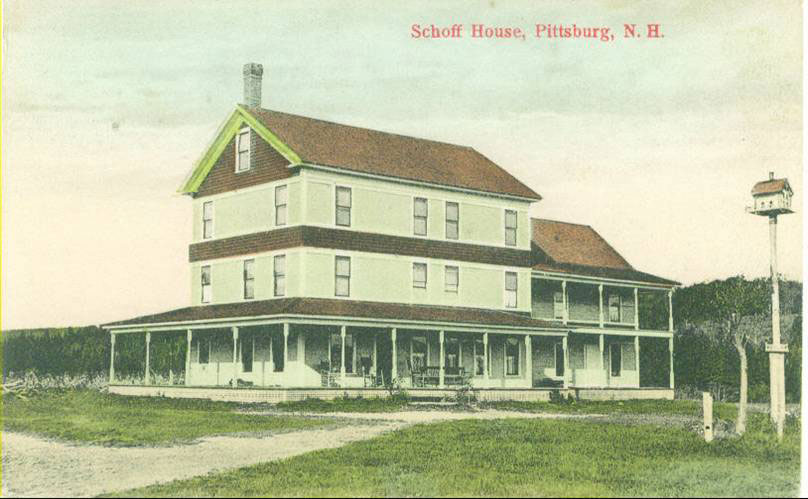
History of the Town of Pittsburg
Pittsburg is a town in Coos County, New Hampshire, United States. The population was 869 at the 2010 census. It is the northernmost town in New Hampshire and the largest town by area in the state – and in New England as well – more than twice the size of the next largest town, Lincoln. U.S. Route 3 is the only major highway in the town, although the northern terminus of New Hampshire Route 145 also lies within Pittsburg.
Pittsburg derives its name from William Pitt, Prime Minister of the United Kingdom. Prior to its incorporation in 1840, the area was settled ca 1810 and known as the Territory of Indian Stream. It had the unique distinction of having been its own microstate briefly during the 1830s, called the Republic of Indian Stream, due to an ambiguous boundary between the United States and Canada.
Pittsburg is the northernmost New Hampshire municipality. It shares an international border with Québec province, Canada to its west and north, and borders the states of Maine (to the east) and Vermont (a very small portion to the southwest). Directly to the south is Clarksville. Pittsburg is the only New Hampshire municipality to border Canada, the only one that borders both Maine and Vermont, and the only one to share a land border with Vermont. Pittsburg contains the only part of New Hampshire west of the Connecticut River, as that river defines the Vermont state line from Clarksville southward. New Hampshire’s only Canadian border crossing is located at the northern end of town at the terminus of U.S. Route 3. The western edge of Pittsburg is defined by Halls Stream, being the “northwesternmost headwaters of the Connecticut River“, which defined (ambiguously) the border in the Treaty of Paris of 1783.
Contained within the boundaries of Pittsburg are the Connecticut Lakes, which form the beginning of the Connecticut River. Pittsburg also contains the communities of Happy Corner, Idlewilde, and The Glen. Early maps (e.g. 1854) also show several grants that were incorporated into the eastern edge of Pittsburg, including Carlisle No. 1,Webster/Carlisle No. 2 and Hubbards No. 3, all north of Atkinson and Gilmanton Academy Grant.
According to the United States Census Bureau, the town has a total area of 291.2 square miles (754 km2), the largest of any municipality incorporated as a town in New England. 281.4 square miles (729 km2) of it is land and 9.8 square miles (25 km2) of it is water, comprising 3.37% of the town.
The highest point in Pittsburg is the summit of Stub Hill, at 3,627 feet (1,106 m) above sea level. Magalloway Mountain, 3,383 feet (1,031 m) above sea level, is a prominent summit reachable by hiking trail with gorgeous views stretching out over the vast wilderness surrounding it.